Event Overview
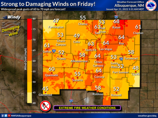
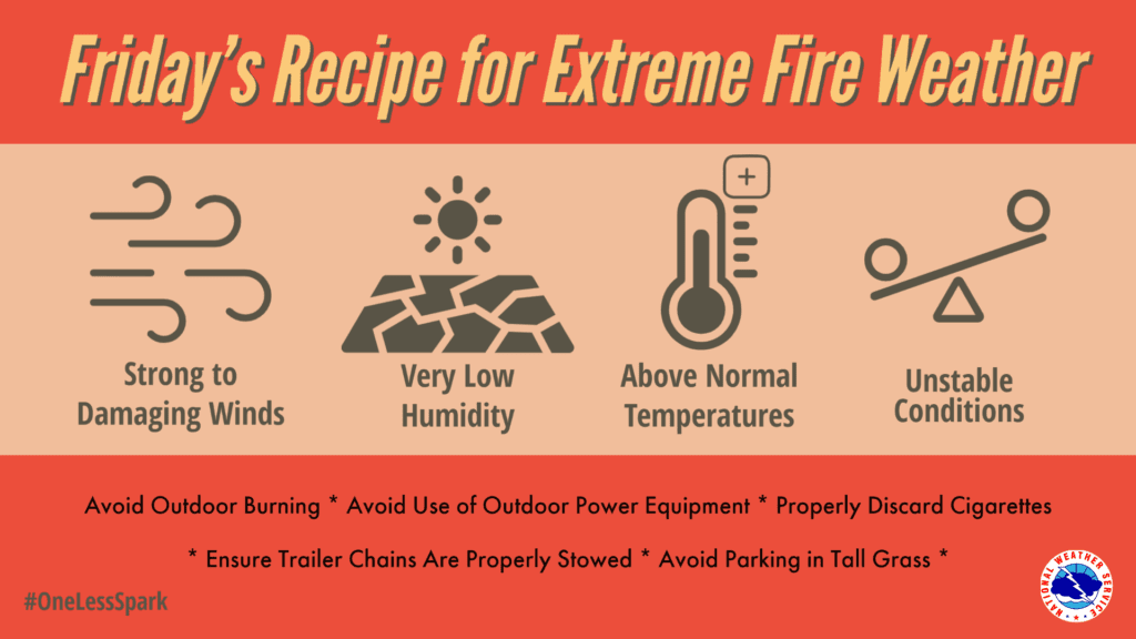
While a strong jet stream moving across New Mexico is common this time of year, the weather scenario on Friday will be especially conducive to widespread damaging winds. The Jet stream will strengthen Friday as it dips over the American Southwest and crosses into the state while a powerful low pressure system bears down on the central Rockies. Above normal temperatures will make it easy for strong winds aloft to mix down to the surface with very dry conditions prevailing. Winds out of the south southwest will rapidly increase during the late morning and early afternoon before peaking in the middle to late afternoon with widespread gusts of 60 to 80 mph expected. Very low humidity and unstable conditions will create extreme fire weather.
Key Impacts
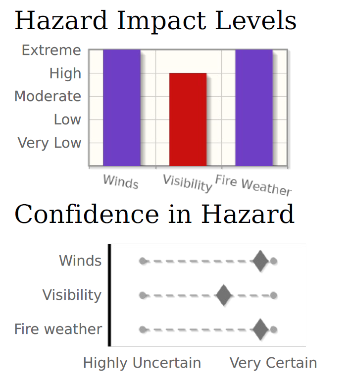
- South Southwest wind gusts of 60 to 80 mph will be capable of producing damage to roof tops, trees utility poles and other vulnerable structures
- Strong cross winds, especially on northwest to southeast oriented roads, will create dangerous driving conditions with the potential for high profile vehicles to topple
- Very dry conditions and low humidity between 5 to 10% will combine with the severe winds to create an extreme fire weather scenario with catastrophic fire growth possible.
Timing
Winds out of the south southwest will rapidly increase late Friday morning into the early afternoon before peaking in the middle to late afternoon. Winds will remain gusty through the evening hours Friday, gradually decreasing toward midnight. Breezy to windy conditions will redevelop on Saturday.